

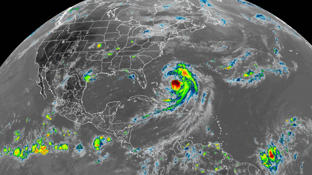
Coast-Wide Alert: Multiple Threats from Hurricane Erin, from Storm Surge and Winds to Rip Currents

As of 5:00 PM EDT Tuesday, Hurricane Erin is a powerful hurricane with 105 mph winds, located about 615 miles south-southeast of Cape Hatteras, North Carolina. On its forecast track, the center of Erin will pass between the U.S. East Coast and Bermuda on Wednesday and Thursday. While the strongest hurricane-force winds are expected to remain offshore, the storm's large size is creating multiple life-threatening hazards for the entire Eastern Seaboard.
A Storm with Multiple Threats
It is critical for all coastal residents to understand the different hazards posed by this storm, as the impacts will vary by location.
1. Life-Threatening Storm Surge (North Carolina) The most urgent and dangerous hazard is storm surge. A Storm Surge Warning is in effect for Cape Lookout to Duck, North Carolina, where the NHC forecasts 2 to 4 feet of inundation if the peak surge occurs at high tide. The NHC stresses this is a "life-threatening situation" and urges residents in this specific area to follow all evacuation orders from local officials.
2. Tropical Storm Winds (North Carolina & Virginia) A Tropical Storm Warning is in effect for the Outer Banks of North Carolina (from Beaufort Inlet to Duck), meaning tropical storm conditions are expected there within 36 hours. A Tropical Storm Watch is in effect for areas north of Duck, NC, up to Chincoteague, Virginia, where these conditions are possible within 48 hours.
3. Dangerous Surf & Rip Currents (Entire East Coast) Even hundreds of miles from the storm's center, the entire U.S. East Coast is at risk. Swells from Erin are generating life-threatening surf and rip currents from Florida to New England. The official Rip Current Risk map currently shows a High Risk for the Southeast and Mid-Atlantic coasts. These conditions can be deadly even on sunny days.
What You Should Do Now
Your immediate actions should depend on your location and the specific warnings in effect for your area.
If you are in a Storm Surge Warning Area (NC): Follow all evacuation and safety instructions from local officials immediately. This is the most dangerous hazard.
If you are in a Tropical Storm Warning/Watch Area (NC/VA): Secure your property for strong winds and prepare for potential power outages.
For ALL Coastal Residents (Entire East Coast): Stay out of the water. The risk from powerful waves and rip currents is severe and widespread. Heed all beach warnings and red flags.
Hurricane Erin is a powerful reminder that a storm does not need to make direct landfall to pose a significant threat. Please stay informed by monitoring the National Hurricane Center and your local weather office, and prioritize safety.