Blog
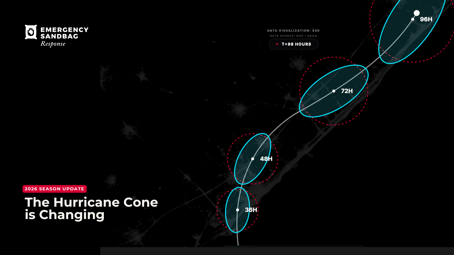
The Hurricane Cone is Changing in 2026: What the New "90% Ellipse" Means for Your Community
The old hurricane forecast cone only captured the storm's path 67% of the time. The NHC's new 90% elliptical cone, launching in 2026, is a significant upgrade. ESR explains the science and what it means for your community.
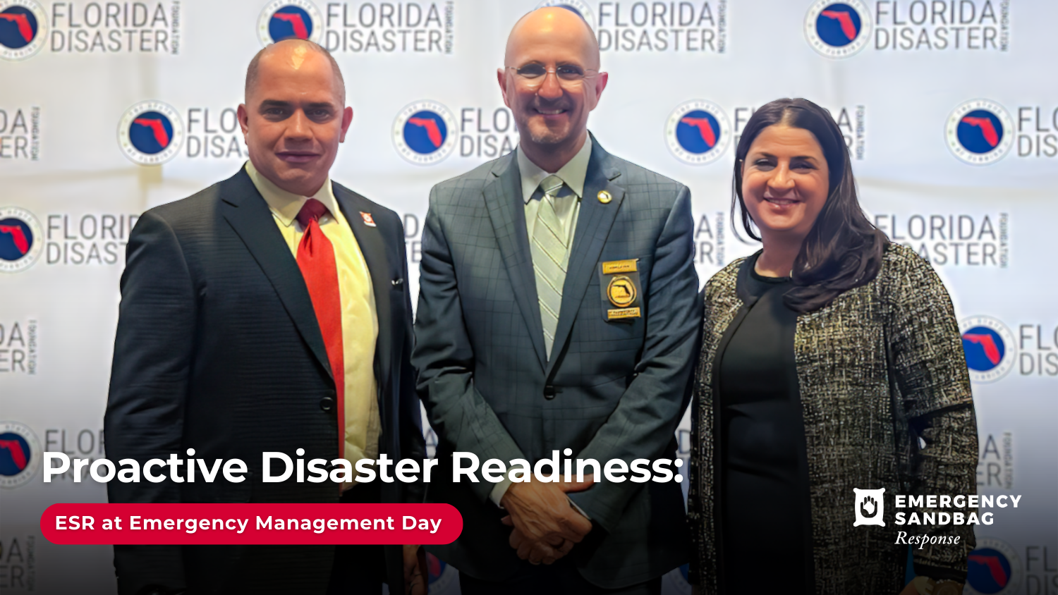
Excellence in Action at the 6th Annual Emergency Management Day
The ESR team attended the 6th Annual Emergency Management Day in Tallahassee. Read our key takeaways on disaster logistics and proactive emergency planning.

Event Alert: Free Sandbag Distribution on Sept. 12 for District 4 Residents (Miami)
On Friday, Sept. 12, a free sandbag distribution event is taking place for residents of Miami's District 4. This initiative, led by the Honorable Commissioner Ralph Rosado.
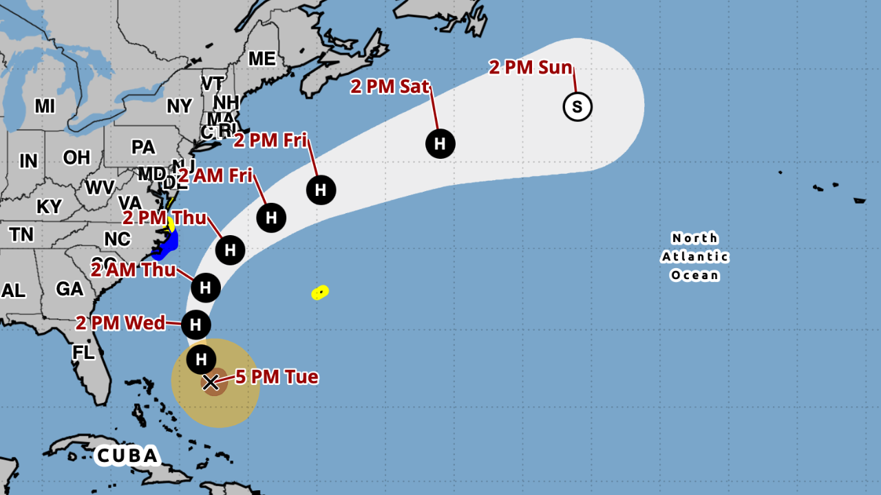
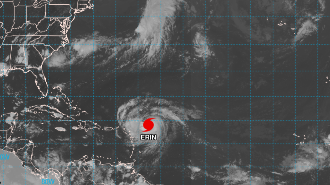
Coast-Wide Alert: Multiple Threats from Hurricane Erin, from Storm Surge and Winds to Rip Currents
While Hurricane Erin's center is forecast to remain offshore, the storm's immense size is creating a multi-faceted and life-threatening situation for the entire U.S. East Coast. A Storm Surge Warning is now in effect for parts of North Carolina, with the potential for life-threatening flooding of 2-4 feet. Tropical Storm Warnings have also been issued for the Outer Banks, as the storm's powerful wind field nears the coast. Beyond the storm's immediate path, dangerous swells are generating life-threatening surf and rip currents from Florida to New England. This post breaks down all the current threats, region by region.